
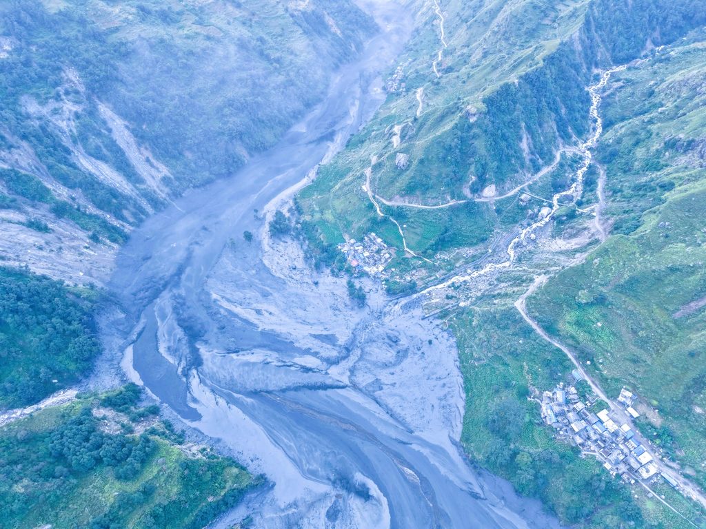
A recent technical report from Nepal’s National Disaster Risk Reduction and Management Authority (NDRRMA) confirms that an avalanche, followed by a significant landslide, caused a massive flood in the Budhi Gandaki River in Gorkha.
The report outlines a series of geological events that led to this disaster, resulting in widespread destruction.
On October 11, at around 4:20 a.m., an avalanche occurred near Ungilung Khola in Chumnubri Rural Municipality-6, at an altitude of 5,500 meters.
Scientists attribute the disaster to low-quality rocks mixed with glacier debris.
The avalanche triggered a landslide that flowed down the mountain, impacting the tributaries of the Budhi Gandaki River.
Avalanche and Landslide Resulted in Significant Debris Flow
The report indicates that the avalanche and the subsequent flow of loose materials, including rocks, water, and snow, surged up to 300 meters above the stream bank.
The Department of Mines and Geology initially measured the disaster’s impact, equating the energy released to a magnitude 3.5 earthquake.
The avalanche created a large debris block at the junction of Ungilung Khola and Syar Khola, obstructing the latter’s flow.
A similar blockage likely occurred at the confluence of Syar Khola and Budhi Gandaki, as noted in the report.
Flooding was exacerbated by water stored behind the debris block.
Significant Debris Increased Flood Intensity
The report emphasizes that the bulk of materials involved in the avalanche was a primary factor in the flood’s severity.
It states, “The large amount of cohesive debris, rather than just water, significantly contributed to the flood in Ungilung Khola.”
The findings reveal that Syar Khola was blocked for about an hour before the flood surged down, causing water to accumulate approximately 1.5 kilometers downstream before being released in multiple waves.
The report confirms that the disaster was not a single flood event, but rather a series of pulses of water.
The release of the blockage generated the most significant flood pulse.
Flood Height Reached 20 to 25 Meters in Salleri
The flood rushed down the Budhi Gandaki on October 11, reaching Salleri around 4:30 a.m.
According to the technical report, the flood peaked at approximately 20 to 25 meters around 6:30 a.m.
The debris and water flow devastated a hydropower project camp and damaged buildings downstream, particularly in Jagat.
Concrete bridges on the Soti Khola and Budhi Gandaki Rivers were also severely impacted.
Narrow mountain valleys can funnel large floods from remote peaks into populated areas, causing chaos and destruction.
The report offers a thorough analysis of the disaster.
Flood Composition Primarily Mud and Debris
The report details the makeup of the flood, noting that soil constituted a larger portion than sand, gravel, and rock fragments.
- This composition gave the flow a mud-like consistency rather than a typical water flood.
- The higher soil content in the debris flow is linked to the region’s geological characteristics.
- This mudflow can inflict significant damage to buildings, bridges, roads, and infrastructure.
- The findings of the technical report will enhance understanding of the mechanisms behind the October 11 disaster in the Budhi Gandaki valley.
- This knowledge will aid in developing disaster risk reduction strategies.
- The avalanche and landslide combined to intensify the flood’s impact.
- The influx of debris alongside the floodwater contributed to the destruction.
- Additionally, the blockage during the avalanche likely increased the flood’s scale.
- The report provides a comprehensive analysis of the disaster’s contributing factors.
- Further research is recommended to gather more information for effective disaster risk management in flood-prone regions.
The findings aim to establish a scientific foundation for creating early warning systems and implementing precautionary measures in vulnerable areas across the country.